TYPE:
SENSOR
LAYER:
DS_PHR1B_202010151530031_FR1_PX_W074N18_0713_00739
FORMAT:
DIMAP
RASTER:
image/tiff
General Information
Map Name
Geometric Processing Level
Radiometric Processing Level
LINEAR_STRETCH
Image dimensions
Number of columns
1511
Number of rows
3960
Number of spectral bands
4
Dataset framing
Vertice
Longitude (DEG)
Latitude (DEG)
Row
Col
#1
-73.45379301542853
18.54013425216767
1
#2
-73.42378043285142
18.53920661240862
#3
-73.4227275993578
18.46476384340746
#4
-73.45312871506165
18.46597015381255
Dataset sources
PHR
Coordinate Reference System
Projected Coordinate System
Geocoding tables identification
EPSG(6.3)
Production
Production Date
2020-11-06T10:58:19.066
Job identification
5467410101-2
Dataset Producer Identification
AIRBUS DS GEO
Producer link
http://www.geo-airbusds.com
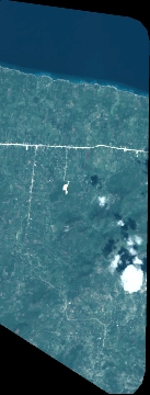
Quicklook
Copyright