The Context
Many ground movements exist in Haiti, some of them occur around the quarries after an intensive exclusion. Indeed a major event (heavy rain, earthquake) can trigger significant erosion rates, loss of arable land, and damage to the floodplains by sediment transport. For these reasons, quarrying is necessary in Haiti, especially since quarries closed by the Ministry of the Environment are sometimes illegally exploited or simply after the opening of new wild quarries.
To follow careers the first thing you need is the automatic detection of these careers. It has therefore been studied what could be the contribution of very high resolution spatial imagery to detect quarries and monitor their evolution. The aim was to propose an automatic methodology for the detection of careers.
Work done by student of UNISTRA, Encadrant LIVE, with CNES (soutenance le 29.06.2018)
Imagery (provider) : Pléiades (CNES)
Products
- Classification and detection of quarries in tropical environment from pleiades images
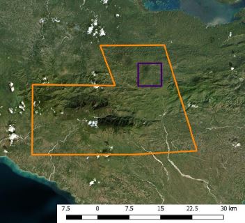
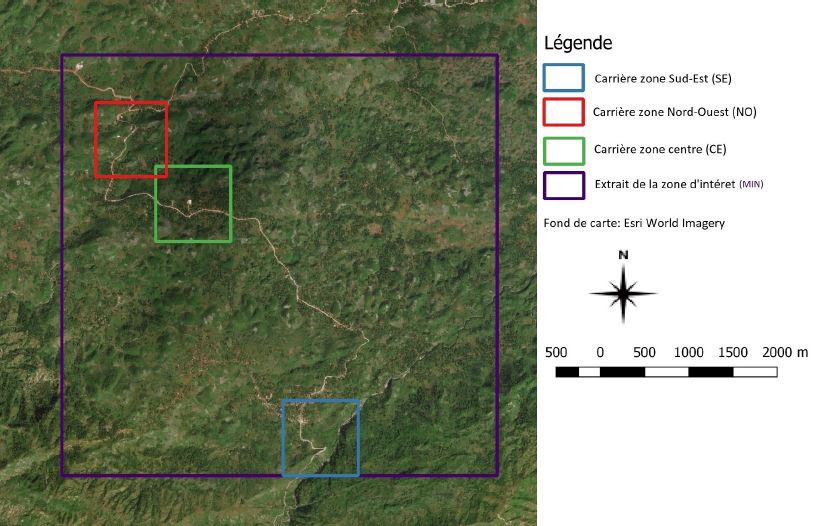
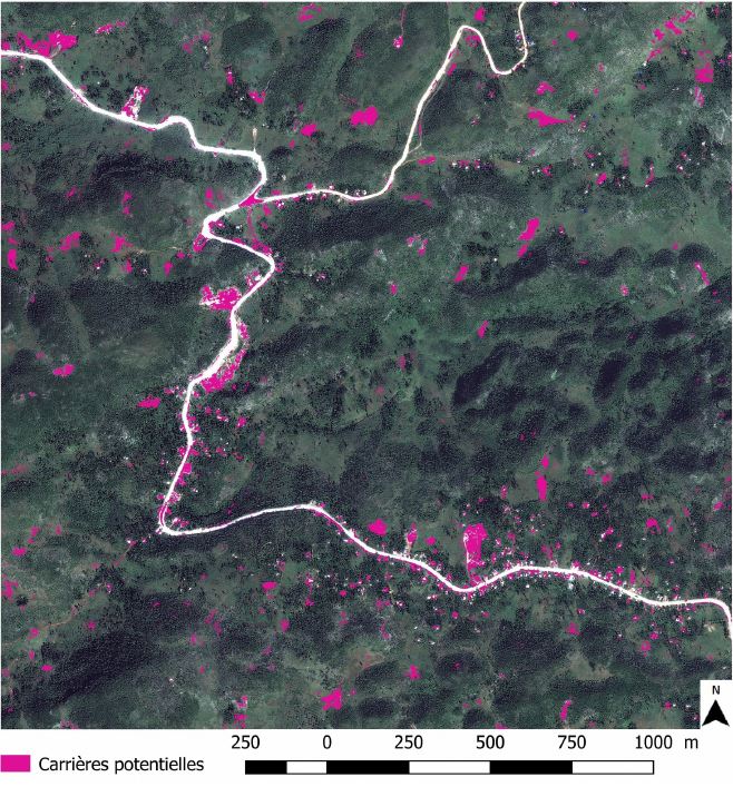
Study area, three zooms were studied on this tile
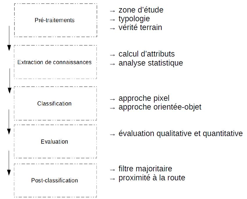
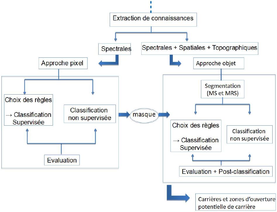
The selected study area is located along the Camp-Perrin <-> Jérémie road, where the BME suspects many illegal mining activities. The methodology is summarized in the graphs below. After selection of the study area, it is necessary to define the classes to extract and extract the knowledge of the field: spectral, textural, topography, geometry, ACP. The study then performed several pixellic steps to extract a particular mask of vegetation and shadows (which can then be subtracted from the image). The object step follows with the segmentation with the use of the OTB.
Feedback from experience
This work allowed a better knowledge of careers through the extraction of knowledge. The results are encouraging on the extract of image and automatable to carry out a temporal follow-up even if it is necessary to note a certain sensitivity on the scale of segmentation (see the presentation in appendix).
Perspectives are visible at the end of this work, first of all the generalization on the whole pleiad image, but also the use of a second image to detect the changes between these classifications. The addition of geological layers would also reduce the areas to be treated.

Post-classification result highlighting potential careers on the North-West Area (in Red previously)
Delivery is available in the attached files :