In 2019, taking advantage of the RO work of 2018 on the theme of land use in Haiti for the establishment of the iota² treatment chain in the territory of Haiti.
Numerous exchanges between CNES, CNIGS and SERTIT took place in order to improve the establishment of the chain, the nomenclature and the training of the CNIGS on the chain in order to develop the land use map annual haîti.
You will find below the final version of the 2018 land use map, produced with Sentinel 2 Theia images, CNES data, SERTIT production in partnership with the CNIGS
2018 Land Use Map of Haiti
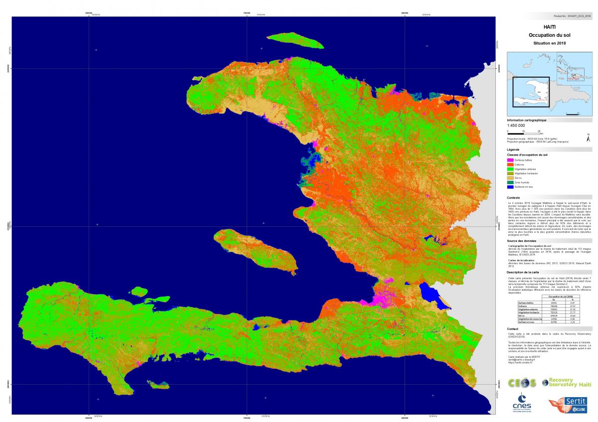
Work carried out with the CESBIO IOTA2 - CNES processing algorithm
Imagery : Sentinel 2 (https://theia.cnes.fr/atdistrib/rocket/#/search?collection=SENTINEL2)
The high resolution .pdf version is available at the following link: High resolution .pdf
The Shapefile version is available in the Spatial database category of the website:
Direct link to 2018 land use map in vector version
Like all cartographic products, it should be noted that this information should be taken with the greatest caution, indeed this geographic information has limitations due to the scale, resolution, date and interpretation of the source data.