
This page lists all the information, the exchanges and the products around the Land cover of Haiti
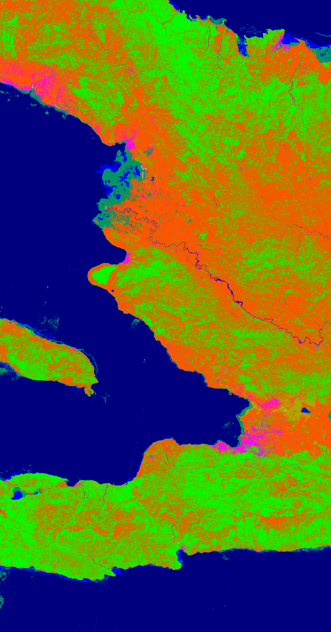 |
The last official land use map for all of Haiti dates from 1998. An update of this map, based on ortho-photo acquisitions in 2014 (25 cm), has been in progress for several years. The methodology used and the detail of this reference map do not allow for a more frequent update, which would make it possible to observe the changes following major events like Hurricane Matthew, but also to observe, in the medium-term, important but more gradual changes. Thematic responsible : MPCE / CNIGS, Philemon Mondesir Work done by CNIGS and CNES Imagery (provider) : Sentinel-2 (EU) As part of the RO, the IOTA2 methodology of Sentinel-2 data analysis (10m resolution) was used to develop a transferable and replicable approach. It will allow CNIGS to generate an annual map of land use changes across the country, based on a simplified classification. This approach will provide the basic national map, while an analysis of Spot, or Pleiades or airborne imagery, will map the evolution of "hot spots" as needed. List and links of elaborated products : 2018 Dec - (CNES) Land Cover 2017 with Sentinel 2 Version 8 (IOTA2)2018 August - (CNES) Land Cover with Sentinel 2 (Master internship)2018 Sept - (Copernicus/EU) EMSN050: OCS Jérémie and Les Cayes
|
Updating this land cover map over the entire area is essential for the different themes of the Recovery Observatory. For this different scales will be considered, not bringing the same stringency of nomenclature nor time of update.
The larger scale will take care of modeling the entire area of the Recovery Observatory, during the development of the product the finest nomenclature achievable will be described. In different areas, considered of major importance for the diversity of the themes they affect but also their changes, hot spots will be determined to make products with higher resolutions and more detailed depending on the areas and needs.
Analysis of Results and Outlook :
A first training session on IOTA2 took place at CNIGS in December 2018, led by CNES and SERTIT. Further training was planned for December 2019 with the aim of processing the 2018 images but had to be postponed in early 2020. In 2020, the land cover map based on the 2019 images will be produced by CNIGS autonomously.
Beyond the annual cartography of the country, which remains the priority objective of CNIGS, the IOTA2 methodology mastered by CNIGS will be used in the TPR project of the World Bank as well as to develop the indicator “Land Use Change” of the future Environmental Information System set up by CNIGS and the National Observatory for the Environment and Vulnerability (ONEV) of the Haitian Ministry of the Environment.
Useful data :
- The 2012 CNIGS / CIAT nomenclature called COS / GRN is available here
- Understanding Priority Zones by Targeting OCS Hotspots


