In 2018, CNES worked on setting up the iota² treatment chain in Haiti. This work and the various related presentations are available on the following link:
Land Cover with Sentinel 2 - CNES internship 2018
Throughout this internship, the goal was to develop the hati land cover map with the available data. This work considered in a series of round trip between the preparation of the input data of the chain and the realization of map. For more details refer to the report available on the previous link.
You will find below the final version of the 2017 land use map (Version 8), made with Sentinel 2 Theia images, CNES data, SERTIT production.
Version 8 of Haiti Land Cover Map 2017
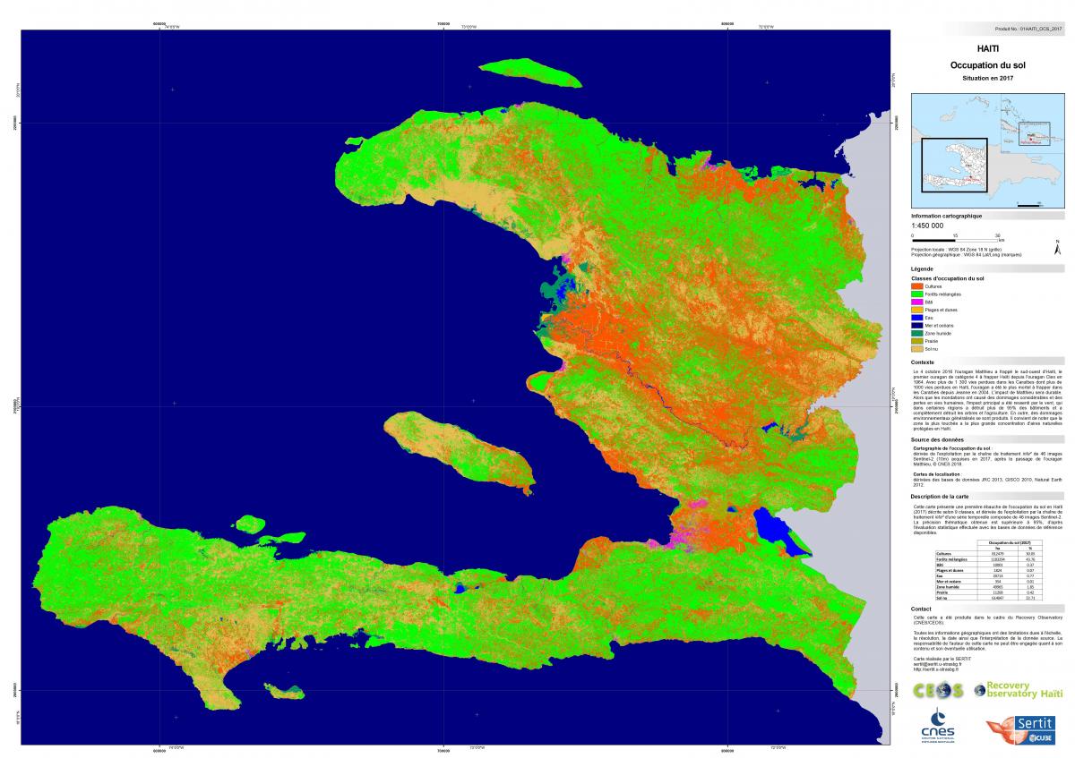
Work done with the CESBIO IOTA2 - CNES chain
Imagery : Sentinel 2 (https://theia.cnes.fr/atdistrib/rocket/#/search?collection=SENTINEL2)
All versions with different resolutions are available in the archive below :
Download ZIP Archive (300dpi, 200dpi,100dpi,50dpi)
Like all cartographic products, it should be noted that this information is to be taken with the utmost caution. Indeed, this geographic information has limitations due to the scale, the resolution, the date as well as the interpretation of the source data. .