The following list present different file that can be usefull for the projet Recovery-Observatory, all those data can be use to create RO products :
Land Use :
The CNIGS / CIAT nomenclature called COS / GRN of 2012 is available here
Land Motion :
. The Geological Map of Haïti is available here
GNSS/GPS Stations
September 2017 progress of the station network GNSS/CORS :
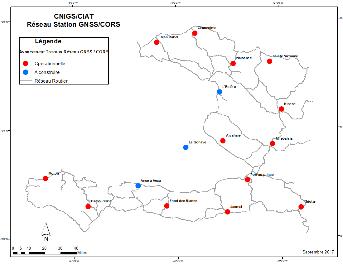
. Coordinates of all Stations :
Shape file
.Stations's data are available at the following link :
ftp://data-out.unavco.org/pub/rinex/
. Information about those data can be found here :
http://www.unavco.org/data/gps-gnss/ftp/ftp.html
. The CNIGS create a website to inform abotu the stations here (available since 19/02/2018) :
http://www.cors.cnigs.ht/
Risk information Map on the Grande Anse Department
UNDP has produced an information map of natural hazards on the Grande Anse Department including seismic risk, flooding and land movements :
The Map is available here (pdf)
Mission Repport after Ground Movement in January 2018 At Jean-Rabel
The BME conducted a mission to Jean-Rabel (Northwest of Haiti - outside RO area) to assess the landslides occurring after rainy episodes in January 2018. This report includes an analysis of the general predisposition of the terrain, a description observed landslides, their types as well as photos.
The repport is available here (french)