During the mission of the Recovery Observatory team to Jérémie in May 2019, many discussions took place around the theme of Macaya National Park, in particular with the park managers, the Macaya UGP.
Following these discussions, a problem emerged: the park's trails are still poorly understood today.
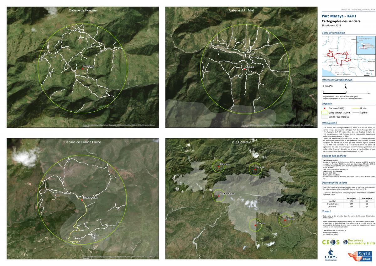
The project subsequently agreed to initiate a feasibility study for mapping these trails.
The stude
The purpose of this study is to carry out, following the request of the Inter-American Development Bank (IDB - IABD), an inventory of visible trails in Macaya Park in 2018 from very high spatial resolution optical satellite data (ie Pleiades 0.5m) available as part of the Recovery Observatory. Firstly, this inventory is carried out within a radius of 1000 meters around three of the surveillance huts established by the Macaya PMU since 2018. The work was carried out by visual interpretation of the images.
Work done by SERTIT, contract CNES
Imagery : CNIGS / CNES
| T_controle | T1 | |
| Orthophoto (25cm) 2014 |
Pléiades (70cm) June 15, 2018 Noth (PAN/ XS) West (PAN/ XS) |
Pléiades (70cm) Décembrer 1st, 2018 Centre (PAN/ XS) |
The aerial ortho-photographic coverage carried out across the country in 2014 was useful in order to control the presence or not of trails at an earlier date, in case of doubt when interpreting the 2018 images.
Conclusion
The path mapping carried out around the three huts has demonstrated the potential linked to the exploitation of very high spatial resolution satellite data distributed within the framework of the Recovery Observatory. Although certainly not exhaustive, the vector layer produced highlights the density of the existing paths in the Macaya Park sector, thus testifying to the significant human activity and the exploitation of the environment.
In the perspective of a full mapping of the trails in the long term, several technical recommendations must be taken into account in order to guarantee an optimal analysis, and this with the aim of a generic and operational application: Adapt the dates of shots , Use a Lidar DEM for the ortho-rectification process and Adapt the image dynamics to allow photo-interpretation in shaded areas.
For more information, the study report is available in the files below.
Final delivery is available in the attached files :
- The study repport in pdf file
- The map in pdf and jpg version 300dpi (also available in .tif .tfw .jgw 100-200-300 dpi on request)
- The vector database on serveur and in .zip file