The objective of this activation is to provide a general reference content to support activities of administration in reconstruction work of damage caused by Cyclone Matthew (October 2016) over two areas of interest containing the cities of Jérémie and Les Cayes, and to understand vulnerabilities during the recovery period. The focus of EMSN-050 activation was the detection of buildings and assets of all kinds affected by the cyclone, and understanding how people temporarily had to relocate their dwelling to the so called Internally Displaced People (IDP) camps, while the reconstruction works were taking place.
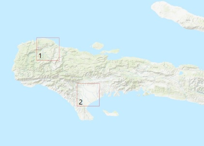
Copernicus demand Areas of Interest : Jérémie (1) and Les Cayes (2)
The technical approach was to build a complete GDB containing the baseline data, and the status of assets and IDP camps in all the required stages, using a common schema in order to make them comparable. Based on the information extracted through visual interpretation of satellite imagery, spatial and temporal analysis was then performed by comparing the status of assets and IDP camps between the different stages.
Results are presented in tables containing, between other indicators, damage to assets, statistics at each monitoring interval, reconstruction progress rates, grouped by administrative boundary of interest (i.e.: sub-commune).
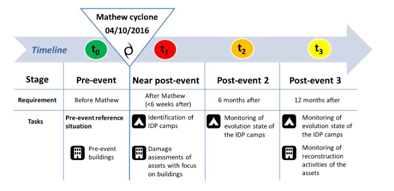 Pre-event baseline conditions (t0) were compared against post-event situation in three time steps:
- t1: days after the event.
- t2: approx. approx. 6 months after (only IDP camps).
- t3: approx. approx. 12 months after.
The products are:
- Evolution state of the IDP camps.
- Damage assessment of assets, focusing on buildings, and monitoring of reconstruction activities of the affected assets.
Evolution of IDP camps in three time stages (t1, t2, t3)
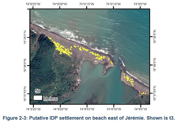 IDPs camps were mapped in three time stages. Indications for precarious housing such groupings of dwellings with a disordered arrangement were searched by visual means using three sets of imagery and were collected at their corresponding time stage.
Overall, very low numbers of putative IDP dwellings have been observed for both AOIs at t1. This suggests that in the few days following the passage of the storm until the satellite image acquisition, most affected people had not yet constructed new shelters. At time t2, numbers of potential IDP dwellings have risen in both sites, but remain low. Thus, the low number of potential IDP dwellings does not imply a low number of internally displaced persons.
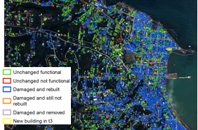
Damage assessment and monitoring of reconstruction: study of the evolution of building status in three time stages (t0, t1, t3)
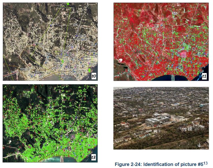 More than 115,000 building footprints were manually digitized by photointerpretation of pre-event ortho image and post-event satellite imagery. The status of every building was coded in three time stages, pre-event (t0), near post-event (t1) and one year after the event (t3). The damage assessment immediately after the hurricane Matthew was assessed by comparing two time stages: Status_t0 and Status_t1. Before the hurricane, 96-97% of the buildings in both AOIs appeared to be functional. Immediately after Matthew, the 93-94% of the buildings in both AOIs presented evidence of damage, visible from above, such as destroyed roofs. Only a 5-7% presented no visible damages far from presence of water on top of flat concrete roofed houses.
The reconstruction status was monitored by comparison of the three status codes at the three time stages: Status_t0, Status_t1 and Status_t3. The possible combination of codes was analysed and their meaning interpreted.
The aggregated figures led to the following main conclusions:
- There was an important reconstruction effort in the first year after Matthew, with a total of 61% of buildings recovered up to the beginning of 2018.
- But there is still an 8% pending of recovery activities.
- The buildings that are not vulnerable to cyclones in both AOIs do not even reach 6% of the total.
- There is a remarkable number of additional buildings in t3 with respect to pre-event conditions, representing an additional 10% of the total buildings in t3.
You will find the final technical report below :
The list of products is available here (Version 2) :
